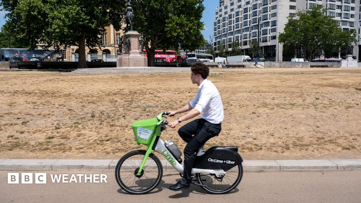
Parts of the UK aren’t just dry. They are parched. Southern, central, and eastern England have slipped into “prolonged dry weather.” This is the precursor to full-blown drought.
The National Drought Group said so on Tuesday. Their warning hits hard because it’s not abstract. It means tap restrictions are coming. Fast.
Who is facing hosepipe bans right now?
Thames Water has drawn a line in the sand. From Thursday, hosepipe bans take effect for all customers in their zone. That affects millions.
Combine that with existing bans in the South East and other regions, and more than 20 million people in the UK are now living under water restrictions by the end of this week.
The areas hardest hit include:
- East Anglia
- The West Midlands
- Devon and Cornwall
- The Isles of Scilly
- Lincolnshire
- Northamptonshire
- Hertfordshire
- London
- The Thames and Wessex regions
- The Solent area
- The South Downs
Thirteen water companies are currently impacted or have announced future bans. Seven have already implemented or signaled upcoming hosepipe bans. The strain on treatment works is immense. Demand spikes up to 30% on hot days this July.
Why do we need bans? Because a single hosepipe can dump 1,000 liters of water an hour. That’s more than a family of four uses in an entire day.
How is a drought actually declared?
There’s no official numerical threshold. Drought isn’t like a heatwave with a specific temperature trigger. It’s a cumulative failure.
The National Drought Group—comprising the Met Office, National Farmers’ Union, and water utility leaders—assesses the situation based on four key factors:
- Lack of rainfall
- Impacts on agriculture and wildlife
- Likelihood of wildfires
- Low water reserves and river levels
High temperatures exacerbate the issue. They evaporate moisture from the soil faster than it can replenish. Human activity plays a role too. Deforestation, intensive farming, and excessive consumption all strip the land of its water-retaining capacity.
Unlike hurricanes or storms, droughts are slow burners. The Met Office notes they build up over time. They can last weeks. Or years.
Farming crisis: Yields and harvests at risk
Farmers are already reeling. Rainfall has been exceptionally low in the east and south this spring and summer.
Paul Tompkins, deputy president of the NFU, says farmers are “working around the clock.” They are harvesting early, watering crops manually, and caring for livestock. It’s exhausting. And expensive.
Cereal yields may drop significantly. This follows difficult harvests in both 2024 and last year’s 2025 cycle. If this pattern holds, food security becomes a real economic worry for the sector.
River flows and reservoir levels: By the numbers
The Environment Agency reports alarming trends in surface water.
- 87% of catchments in England are at “below normal to exceptionally low levels.”
- Specific rivers like the Avon, Cam, Derwent, Swale, Tone, Wye, and Yare are critically low.
- National reservoir storage sits 5% below the long-term average.
- Groundwater levels are dropping, particularly in the Cotswolds and Wessex Downs where they are notably low for the season.
Last summer, drought was declared across England, Wales, and eastern Scotland. It ended only four months ago. This year, it developed slower. Why? A wet autumn and winter recharged aquifers. But that buffer is now gone.
Will drought get worse? What does 2055 look like?
This isn’t a temporary blip. It’s a structural shift.
The National Drought Group predicts that by 2055, England will need an extra 5 billion liters of water daily just for public supply. Current infrastructure can’t meet that demand.
Water companies are trying to catch up. Ten new reservoirs are in development. Desalination plants—treating seawater—are being explored. But these are expensive, slow, and energy-intensive solutions.
The science is clear. Climate change is altering the baseline. The UK Centre for Ecology and Hydrology warns that “flash droughts” will become more frequent. These are sudden transitions from wet to dry conditions. They give communities less time to react.
The Met Office projects that by 2070, summers in the UK could be up to 1-6°C warmer and 60% drier compared to 1990 levels. High pressure systems will dominate. Rain-bearing fronts will fizzle out before reaching the south and east.
Regional rainfall breakdown: Who got none?
July has been disastrous for many parts of the UK.
England received just 3% of its long-term expected rainfall. Some areas saw zero rain at all. Wisley in Surrey endured 33 consecutive dry days.
Wales isn’t faring well. Only 5% of July’s expected rainfall fell. Natural Resources Wales has placed the north and south-east regions into “prolonged dry weather status.” That’s the first formal step in their drought protocol.
The UK as a whole saw below-average summer rainfall so far, but the contrast is stark. Northern and western Scotland actually saw above-average rain in the first half of summer. By mid-July, eastern England had received just 26% expected. The disparity highlights how localized these climate shocks are becoming.
What happens next week?
Don’t expect rain. High pressure is in control. For at least five days, significant rainfall is off the table.
Some midweek showers might touch coastal areas in south-east England, East Anglia, and northern Scotland. But rain-bearing fronts moving in from the northwest this weekend? They’ll likely dump their load in Northern Ireland or Scotland. By the time they push south, they’ll have dried up.
The rest of the summer remains uncertain. Models hint at continued warmth and dryness, especially in the south. Thunderstorms are possible, but they’re erratic. Unpredictable.
We’re used to water being a constant. It’s starting to feel like a luxury. The taps keep running for now. But the warning signs are everywhere. And the clock is ticking on those reserves.